Background
By comparison to measuring area coverage, measuring the thickness of floating sea ice with satellites is extremely hard. The traditional way of doing it is to bounce radar-waves off the ice surface, and time their return. However this technique relies on radar waves (in the “Ku-band”) penetrating any overlying snow cover. Another technique uses a higher frequency of radar-waves (“Ka-band”), which are assumed to bounce off the snow surface. In both cases, the assumption of either total or negligible snow penetration by the radar-waves is key to accurate measurement of the sea ice.
One of ESA’s next-generation satellite missions (CRISTAL) aims to use the differences in these two frequencies to measure the snow depth itself. By assuming the Ku-band radar waves penetrate the snow, and Ka-band radar waves bounce off the top, the difference in the timings of the returns will theoretically give the snow depth. Retrieving snow depth over sea ice is a formal mission requirement of CRISTAL, with an ‘uncertainty goal’ of of 5 cm.
Uncertainties in Radar Penetration of Snow
However, there is evidence that Ku-band radar-waves sometimes do not reach the ice surface as intended, and Ka-band radar-waves sometimes unintendedly penetrate the snow. Reasons for this include the presence of stratigraphic-layering in the snow and the presence of brine in the snow. One satellite-based study suggested that Ka-band radar waves from the AltiKa satellite were scattered from ~45% down into the snowpack, whereas Ku-band waves from CryoSat-2 only penetrated 82%. A recent publication indicated that Ka-band radar waves emitted from an aircraft scattered from further away than Ku-band waves for part of the flight. Another airborne-based study also indicated that the ‘main scattering surface’ for Ku-band radar waves was closer to the top of the snow than the bottom.
Fieldwork!
Jeremy Wilkinson (BAS) and I digging a snow pit. A tabular iceberg can be seen on the left-horizon. Photo by Timo Hecken, German Heliservice.
If CRISTAL is to be a full success over sea ice, we need to better understand when our assumptions of full/negligible radar-wave penetration are true, and when they fail. Improving this understanding is part of a recently-funded NERC project named DEFIANT. I was lucky to lead the radar-physics component of the first DEFIANT field campaign in the Weddell Sea of Antarctica, where we measured radar penetration depths from snow covered sea ice. We did this using a sled-mounted radar which worked in both the Ku- and Ka-bands. The radar has a much higher range resolution than satellites, and so allows us to look at where most radar waves return from as a function of height (with ~2cm resolution). Our field campaign took place over two months in March and April, where we worked from the German research vessel Polarstern as it broke through the marginal ice zone near the edge of the pack. Here we encountered recently formed sea ice that was generally too thin to walk/land on, interspersed with thicker ice floes that had survived the summer melting season.
The radar instrument stands next to us while we dig a snowpit over rough sea ice. Photo Timo Hecken, German Heliservice.
We generally visited the sea ice floes by helicopter. This involved taking apart the radar each day and strapping it to its sled for transport, then reassembling it at the field site. This was a pretty stressful experience, as the radar is extremely fragile. The sled and radar fit in the back of the helicopter with around 2cm to spare! Selecting a floe was pretty difficult; as soon as we landed we would drill the floe to mesaure its rough thickness, in part to check it was safe to depower the helicopter there. Floes were often much thicker or thinner than we guessed from the air.
Because of the terrible weather that we encountered throughout the campaign, we were only able to do radar work on five days. We managed to dig seventeen snow pits on five floes, each of which we scanned with the radar at both frequencies. In our snow pits we measured (where possible) snow temperature, hardness and density profiles. We also mapped the stratigraphy (layering structure), took photographs and made other more general observations of the snow condition.
The floe that supported us on the final day. By this point we were drifting freely and the floe was rotating and moving relative to its neighbours. Photo Timo Hecken, German Heliservice.
What We Saw
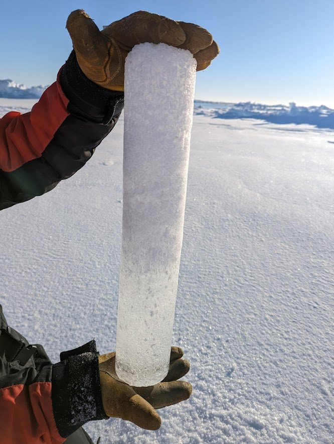
The snow that we found on our campaign had an idiosyncratic character: we consistently observed an underlying layer of remnant snow that was present during the summer, and an overlying layer of snow that had been deposited in the “cold season” which had started a few weeks prior. The remnant snow layer had been heavily modified by the summer weather: the grains were large and so well bonded that it was mostly impossible to dig. At times it had undergone so much melting that there was a thick layer of solid, freshwater ice near the bottom (see photo below). This begged the question of what was really snow and what was ice? On top, the snow that had been deposited recently was much more like the snow that we encounter in Europe or the contiguous USA: softer, lighter, diggable with a shovel. Both layers (‘cold season’ and ‘remnant’) had internal stratigraphy: hard layers, soft layers, and transitions. On one occasion we encountered a striking ice lens within the snow (see photo below).


So what were the results? Did Ku-band radar waves penetrate to the sea ice surface? Did Ka-band radar waves just bounce off the top of the snow? There are a lot of people with a stake in this data, so I can’t share the full story on my website right now. But the story of Ku/Ka interaction with snow is clearly a lot more complicated than full/negligible penetration.
We’ll continue to work on the radar and snow data over the next few months at CPOM, but for now I’m really grateful for the support of Jeremy Wilkinson and Povl Abrahamsen (both from BAS) while in the field. They’re both hugely experienced and were incredibly supportive of me while we were down south. Without them I’d have been lost! And I’m also grateful to my supervisor Julienne Stroeve for backing me to go – KuKa is both expensive and fragile, so entrusting it to a PhD student was a bit of a leap of faith. It’s also really cool that such a large NERC project can involve students like me! On that note I’ll also be on DEFIANT’s next bit of fieldwork next year: overwintering on the Antarctic peninsula with the same instrument. Probably another blog post for that though...